
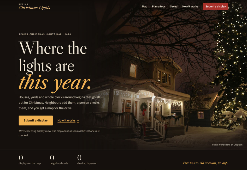
Regina Christmas Lights Map
Regina Christmas Lights is a free map of the houses, yards and whole blocks around Regina that go all out for Christmas. I built it this fall, and it is now open for people to add their displays.
The idea is simple. Every December, people here drive around after supper looking for lights, and the good streets get passed along by word of mouth or in a Facebook thread that is gone by next year. I wanted one place that keeps them: a map you can open on your phone, built by the people who live on those streets.
What you can do with it
The site does three things, and none of them need an account or an app.
- Find displays. Search by street, neighbourhood or type of show, or tap “Lights near me” and the map sorts by what is closest.
- Plan a drive. Add the displays you like to a tour, put the stops in order, and open turn-by-turn directions on your phone. The tour has its own link, so you can send it to whoever is driving.
- Add a display. Yours, or a neighbour’s if they agree. The form takes about two minutes: an address or a pin on the map, dates and hours if you know them, and a photo if you have one.
You can also save favourites. They stay in your browser, so there is still nothing to sign up for.
How a display gets on the map
Every listing comes from someone in the community, and a person reads each one before it is published. Nothing is copied from other websites.
Most displays are private homes, so I spent more time on privacy than on anything else:
- A private home can be shown by street or block instead of its full address.
- You should only add someone else’s house with their permission.
- Location data hidden inside uploaded photos is removed, and photos stay private until the listing is approved.
- Owners have their own correction and removal form, and those requests are handled first.
Each listing also says whether it has been checked in person or is shown as submitted, so you know how much to trust the hours before you load up the car.
How it’s built
The whole site runs on ordinary shared hosting with no paid services behind it. That constraint shaped most of the technical choices.
| Part | What I used | Why |
|---|---|---|
| Server | PHP 8.3 and MySQL, no framework | Runs on a basic hosting plan and installs by uploading one zip |
| Front end | Plain JavaScript, no build step | Nothing to compile, and less to break in two years |
| Map | Leaflet with MapLibre, tiles from OpenFreeMap | Free, no API key, and built on OpenStreetMap data |
| Address search | City of Regina open address data, stored on the site | Addresses people type never leave the site |
| Directions | Links that open in the phone’s own maps app | No routing service to pay for or maintain |
The map page also works without JavaScript: the list of displays is plain HTML, and the map is added on top when the browser can run it.
For the look, I wanted it to feel like a December night rather than a template: dark and warm, with real photographs. The photos on the site right now are stock pictures, credited on the About page. Regina’s own photos show up on the home page and on each listing as people send them in.
Where it stands, and how to help
The site is live at reginalights.ca and the map is empty on purpose: it fills in as people in Regina add to it. I would rather start with ten real displays than a hundred copied ones.
If you live here, there are two things that help:
- Add a display. If your place is lit up this year, or you know one worth the drive, put it on the map.
- Pass it on. Send the link to the neighbour who starts hanging lights in October.
It is free to use and free to list, and it will stay that way. If something on the map is wrong, there is a report link on every listing.